Alt Otjompaue Sud
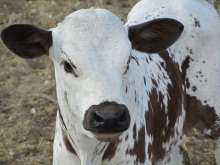
- Cattle farming
- 55.4 km2
Alt Otjompaue Sud is situated in the southern part of the Windhoek Green belt Landscape.
Daan Viljoen Game Park
- State reserve
- Tourism
- 39.4 km2
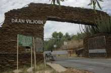
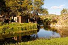
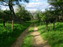
Proclaimed before Independence to preserve the ecosystem of the Khomas Hochland, the park was named after a former Administrator, Mr Daan Viljoen, who played a major part in establishing the park. The convenient location of the park makes Daan Viljoen an ideal venue for day visits. With game drives and hiking trails, Daan Viljoen is a perfect stopover for tourists seeking the tranquillity of the bush and an ideal place for visiting school children to learn more about wildlife and conservation in Namibia.
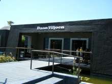
Daan Viljoen Game Park is managed by the Ministry of Environment and Tourism while the accommodation facilities are run privately under a Public Private Partnership with Namibia Wildlife Resorts. Accommodation within the park has recently been extensively renovated and is now run by Sun Karros Lifestyle Safaris. Facilities include conference facilities and accommodation.
| Park size: | 39 km2 |
| Year proclaimed: | 1968 |
| Natural features: | Khomas Hochland Plateau, scenic views of the Windhoek valley |
| Vegetation: | Highland shrubland, with various Acacia species, kudu bush (Combretum apiculatum) and buffalo thorn (Ziziphus mucronata) |
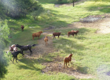
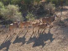
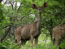
| Wildlife: | Mammals include springbok, kudu, eland, gemsbok, blue wildebeest, Hartmann's mountain zebra, leopard and klipspringer. Of 200 bird species, endemics include Rüppell's parrot, white-tailed shrike and Monteiro's hornbill. |
| Tourism: | Resort with 19 contemporary African chalets, 12 camping site and picnic sites. Activities include game drives, hiking trails and mountain biking trails. |
| Key management issues: | Poaching is problematic due to Daan Viljoen adjoining a high-density residential area. The Augeigas River, which runs through the park, is polluted. |
Duesternbrook
- Game farming
- Tourism - Guest Farm
- Tourism - Hunting
- 137.6 km2
A wide range of game species occur here, and we have a network of cameras which allow us to monitor the game without undue disturbance.
Farm Augeigas 34 Portion 13
- Cattle farming
- 5.2 km2
Farm Augeigas 34 Portion 3 Malabar
- Cattle farming
- 14.3 km2
Farm Augeigas Residential portions
- Residential
- 0.4 km2
Four sections in the south-east of the landscape are used for residential purposes.
Godeis
- Cattle farming
- Game farming
- Tourism
- Tourism - Guest Farm
- Tourism - Hunting
- 70.0 km2
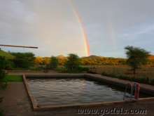
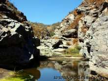
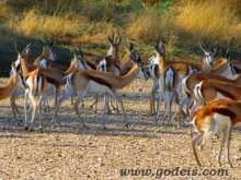
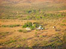
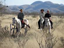
On the most western part of the landscape, 70 km from Windhoek you will find Farm Godeis with its majestic mountain ranges and beautiful valleys. Springbok, Oryx, Kudu, Zebra and Warthogs are among the wildlife that will bedazzle your experience. Farm Godeis has been family owned for over 100 years. Activities available include hiking, mountain biking, trail running, camping, hunting. We welcome you to our warm and friendly family home.
Hochfels Airy 386
- Tourism - Hunting
- 40.8 km2
Klein Onduno
- Tourism - Hunting
- 152.6 km2
The primary land use is hunting tourism, and the Onduno Hunting Ranch is located here. Onduno forms part of the Khomas Hochland Hunting Conservancy which is an extensive area comprising of 200,000 ha of hunting land.
Monte Christo
- Cattle farming
- Tourism - Guest Farm
- Tourism - Hunting
- 59.1 km2
Monto Christo is owned and managed by Family Röthel.
The farm house hidden under majestic century old trees provides the most relaxing atmosphere to unwind and laze around.
The vast variety of wildlife including Waterbuck, Wildebeest and Impala will astound your experience on this farm.
We welcome you heartily!
Ombunja 515
- Cattle farming
- 50.7 km2
Ongos
- Game farming
- 13.6 km2
Otjiseva
- Cattle farming
- Tourism - Hunting
- 92.1 km2
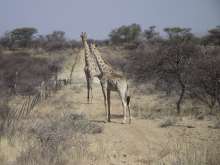
Situated in the north-eastern section of the landscape, Otjiseva is managed as a cattle and hunting farm. Game species present include oryx, kudu, zebra, warthog, giraffe, springbok, leopard, hyena and cheetah.
Portion 1 of Kaujetupa
- Cattle farming
- 26.1 km2
Portions 2&4 of Kaujetupa
- Cattle farming
- 48.4 km2
Literature for Daan Viljoen Game Park
» See our Literature and other resources section for more general information
-
Aquatische Habitatnutzing von Flusspferden (Hippopotamus amphibius) in Dusternbrook
Aquatische Habitatnutzing von Flusspferden (Hippopotamus amphibius) in Düsternbrook. André Battermann, Dezember 2011/January 2012
Aquatic habitat of hippos in Dusternbrook» Download -
Baseline Study of Bush Encroachment and Available Management options
Baseline Study of Bush Encroachment and Available Management options for the Windhoek Green Belt Landscape. Prepared by Logos Consulting and the Polytechnic of Namibia – School of Natural Resources and Tourism by Dave Joubert, Ibo Zimmermann, Nathanael Nuulimba and Hugh Pringle for Ministry of Environment and Tourism Directorate of Environmental Affairs Through NAMPLACE Project
» Download -
Baum und Strauchvegetation rund um Düsternbrook
Baum und Strauchvegetation rund um Düsternbrook
Tree and shrub vegetation around Düsternbrook» Download -
Bird species list for the landscape
Bird species list for the landscape, derived from data collected by the Southern African Bird Atlas Project (SABAP) phase 1. Harrison J.A., Allan D.G., Underhill L.G., Herremens M., Tree A.J., Parker V. & Brown C.J. (eds). 1997. The atlas of southern African birds. BirdLife South Africa, Johannesburg
» Download -
Birds of Düsternbrook Guest Farm
List of 180 birds observed at Düsternbrook Guest Farm, compiled in November 2006
» Download -
Common Birds of Düsternbrook Guest Farm
Illustrated list of Common Birds of Düsternbrook Guest Farm
» Download -
Constitution of the Windhoek Green Belt Landscape Association
Constitution of the Windhoek Green Belt Landscape Association
» Download -
Daan Viljoen Game Park - Profile
Daan Viljoen Game Park - Profile
» Download -
Düsternbrook - fighting bush encroachment
Düsternbrook - fighting bush encroachment. Provisional report after Sep 2011 fire
» Download -
Game estimates for Dusternbrook and Ombota
Game estimates for Dusternbrook and Ombota February 2012
For 22 species, gives numbers utilised in 2011, estimated number on the farm and planned utilisation in 2012.» Download -
Geology of Dusternbrook and the Khomas Hochland
Geology of Dusternbrook and the Khomas Hochland.
In German and in English» Download -
Invasive alien plants in the Daan Viljoen Game Park
Shapaka, T.N., Cunningham, P.L. and Joubert, D.F. 2008. Invasive alien plants in the Daan Viljoen Game Park. Dinteria, 30: 19-32
» Download -
Legal assessment of City of Windhoek’s boundary extension status
Legal assessment of City of Windhoek’s boundary extension status
The WGBL decided to seek a legal opinion on the aspects surrounding the CoW boundaries extension and its implication to privately owned land.» Download -
Mammal species list for the landscape
Checklist of mammals known or expected to occur in the Windhoek Green Belt landscape
» Download -
Namibia Climate Change Vulnerability and Adaptation Assessment
Ministry of Environment and Tourism. 2008. Climate Change Vulnerability and Adaptation Assessment Namibia. Final Report
Vulnerability and Adaptation assessment to climate change carried out in preparation of the Second National Communication in meeting Government’s obligations to the UNFCCC. The report addresses the vulnerability of the water and agricultural sectors to climate change, and suggest adaptation measures to cope with the expected impacts. Vulnerability is placed in the socio-economic contexts of rural areas, in particular the Karas and Caprivi regions.» Download -
Providing relevant, useful information on Namibian vegetation types
Strohbach B.J. 2012. Providing relevant, useful information on Namibian vegetation types. Agricola 22 7-39
This paper outlines the methodology of the Vegetation Survey of Namibia project and uses 6 vegetation associations of the Khomas Hochland as an example.» Download -
Strategic Environmental Assessment of the tourism sector for the Windhoek Green Belt Landscape
Strategic Environmental Assessment of the tourism sector for the Windhoek Green Belt Landscape
This report summarises the outcomes of the strategic environmental assessment of the tourism sector in the Windhoek Green Belt Landscape.» Download -
The birds of Daan Viljoen Game Reserve
Clinning, C.F. and Jensen, R.A.C. 1971. The birds of Daan Viljoen Game Reserve. Windhoek: Divison of Nature Conservation
Popular illustrated guide to the commoner birds of the reserve, with complete checklist at time of publishing -
The distribution and invasive potential of fountain grass Pennisetum setaceum in Namibia
Joubert D. F. & Cunningham P. L. 2002. The distribution and invasive potential of fountain grass Pennisetum setaceum in Namibia. Dinteria, 27, 37-47
» Download -
The ecological, social & economic implications of private game parks & private nature reserves in Namibia
The ecological, social & economic implications of private game parks & private nature reserves in Namibia
The Ministry of Environment & Tourism commissioned this study into the ecological, social, and economic implications of private game parks and nature reserves in Namibia. The Ministry engaged the services of an independent team of researchers consisting of an ecologist, an economist and a lawyer.» Download -
The effects of fire on bush encroachment
The effects of fire on bush encroachment (Düsternbrook Farm 2011-2012)
Rationale: To investigate the use of fire as a management tool to reduce bush encroachment thus, gain a better understanding of its effects» Download -
The leopard population on Düsternbrook game farm
The leopard population on Düsternbrook game farm: A pilot study. Shaun Astbury, August 2011
The aim of this study was to provide an estimate of the distribution, abundance and population density of leopard on the farm from a combined track identification and remote camera trap survey, and GIS spatial analysis.» Download -
Tree and shrubs of Düsternbrook
Tree and shrubs of Düsternbrook
Spreadsheet giving information on growth forms, medicinal uses etc» Download -
Tree species list for the landscape
Tree species list compiled from the Tree Atlas of Namibia data. Curtis B. & Mannheimer C. 2005. Tree Atlas of Namibia. Windhoek. National Botanical Research Institute.
» Download -
Water Quality Assessment Dry Season Results
Water Quality Assessment, Dry Season Results. Weller Consulting Services cc
» Download -
Windhoek Green Belt Landscape Strategic Co-management & Development Plan [English]
Windhoek Green Belt Landscape Strategic Co-management & Development Plan
This co-management & development plan for the “Windhoek Green Belt Landscape” (WGBL) sets out the vision, purpose and objectives and underlying principles for the key issues, which the participants (members of the WGBL Association and collaborating partners) wish to address in the co-management and development of the Landscape. It also lists agreed “actions” under each of the issues, to facilitate the effective implementation of the plan. As such, this plan represents the wishes and intentions of the participants. The co-management & development plan is accepted as the guiding authority for the Landscape.» Download -
Windhoek Green Belt Landscape Strategic Co-management & Development Plan [German]
Windhoek Green Belt Landscape Strategic Co-management & Development Plan
This co-management & development plan for the “Windhoek Green Belt Landscape” (WGBL) sets out the vision, purpose and objectives and underlying principles for the key issues, which the participants (members of the WGBL Association and collaborating partners) wish to address in the co-management and development of the Landscape. It also lists agreed “actions” under each of the issues, to facilitate the effective implementation of the plan. As such, this plan represents the wishes and intentions of the participants. The co-management & development plan is accepted as the guiding authority for the Landscape.» Download
