Affirmative action farms
Freehold farms Jachtplaats (A & B), Okomiparara, Otjihevita, Oupiu and Ringklip
Freehold farms Jachtplaats (A & B), Okomiparara, Otjihevita, Oupiu and Ringklip
African Wild Dog Conservancy
- 3,824 km2
With an area of over 3,800 km2, African Wild Dog conservancy covers a large area in the south of the landscape. The conservancy was gazetted in 2005 and over 4,400 people live here. Annual rainfall is 350 - 400 mm.
With an area of over 3,800 km2, African Wild Dog conservancy covers a large area in the south of the landscape. The conservancy was gazetted in 2005 and over 4,400 people live here. Annual rainfall is 350 - 400 mm.
Ministry of Environment and Tourism (Waterberg Plateau Park)
- Environmental education
- State reserve
- Tourism
- 405 km2
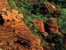
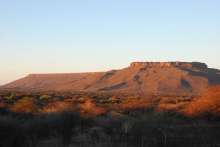
Towering sandstone cliffs, dinosaur footprints, mysterious rock engravings and some of Namibia’s most rare and valuable game species are synonymous with the Waterberg Plateau Park. Proclaimed in 1972 as a sanctuary for rare and endangered game species, Waterberg has played a vital role in breeding species for the restocking of other parks and conservation areas. The area is also home to the last remaining population of Cape vultures in Namibia.
The park has been zoned into management areas for wilderness, trophy hunting and tourism. The Bernabé de la Bat Rest Camp is one of Namibia’s most visited resorts.
Thousands of surrounding community members receive training at the Okatjikona Environmental Education Centre annually. Situated on the fringe of the park, this is one of Namibia's leading environmental education centres. It hosts school, university and institutional groups and organises learning tours of the Waterberg in conjunction with park staff. It strives to establish environmental education programs that will promote environmental education as a continuous process that occurs in and out of school and considers the environment in its totality, emphasising the compatibility of conservation and sustainable development.
Okamatapati Conservancy
- 3,096 km2
Okamatapati Conservancy was gazetted in 2005, covers an area of over 3,000 km2 and supports approximately 1,860 people. It falls within the Kalahari Sandveld landscape and has an average annual rainfall of 350 - 450 mm.
Okamatapati Conservancy was gazetted in 2005, covers an area of over 3,000 km2 and supports approximately 1,860 people. It falls within the Kalahari Sandveld landscape and has an average annual rainfall of 350 - 450 mm.
Otjituuo Conservancy
- 6,133 km2
Gazetted in 2005, Otjituuo Conservancy covers an area of more than 6,100 km2 and approximately 5,800 people live here. Annual rainfall is 350 - 400 mm and the area falls within the Kalahari sandveld landscape.
Gazetted in 2005, Otjituuo Conservancy covers an area of more than 6,100 km2 and approximately 5,800 people live here. Annual rainfall is 350 - 400 mm and the area falls within the Kalahari sandveld landscape.
Ozonahi Conservancy
- 3,204 km2
Gazetted in 2005, Ozonahi Conservancy covers an area of more than 3,200 km2. Almost 11,000 people live here. Annual rainfall is 350-400 mm and the area falls within the Kalahari sandveld landscape.
Gazetted in 2005, Ozonahi Conservancy covers an area of more than 3,200 km2. Almost 11,000 people live here. Annual rainfall is 350-400 mm and the area falls within the Kalahari sandveld landscape.
Resettlement farms (Elandsweide A, B, C, D & E)
A group of 5 resettlement farms - Elandsweide A to E - bordering Ozonahi Conservancy to the east and freehold farms to the west.
A group of 5 resettlement farms - Elandsweide A to E - bordering Ozonahi Conservancy to the east and freehold farms to the west.
Waterberg Conservancy
- Cattle farming
- Environmental education
- Game farming
- Private reserve
- Tourism - Guest Farm
- 1,668 km2
Registered in 1993, Waterberg Conservancy is a freehold conservancy. A freehold conservancy is a legally protected area of a group of bona fide land-occupiers practicing co-operative management on freehold land.
Registered in 1993, Waterberg Conservancy is a freehold conservancy. A freehold conservancy is a legally protected area of a group of bona fide land-occupiers practicing co-operative management on freehold land based on:
- a sustainable utilisation strategy,
- promoting conservation of natural resources and wildlife,striving to re-instate the original bio-diversity with the basic goal of sharing resources amongst all members,
- striving to re-instate the original bio-diversity with the basic goal of sharing resources amongst all members.
The following organisations and farms are members of Waterberg Conservancy:
- Aroma
- Bergview
- Droehout
- Elandsvreugde
- Groenhout
- Hamakari
- Hamakarie-suid
- Hebron
- Hermain
- Hohenstein
- Imhoff
- Klein Hamakari
- Mirage
- Neu-brakpan
- Nog verder
- Okaharu katiti
- Okambukonde
- Okambukonde West
- Okamuru
- Okosongomingo
- Okuzauna
- Ombujomatemba
- Ombujosondu
- Omuverume-nord
- Onjombompapa
- Oros
- Osonanga
- Osonanga
- Otjahewita
- Otjosongombe
- Otjurutjondjou
- Rodenstein
- Schangen
- Teutoburg
- Treurniet
- Uitsig
- Vaalwater
- Warlencourt
» See our Literature and other resources section for more general information
-
A supplementary feeding scheme in the conservation of the Cape Vulture at the Waterberg, South West Africa/Namibia
Brown CJ & Jones SJA. 1989. A supplementary feeding scheme in the conservation of the Cape Vulture at the Waterberg, South West Africa/Namibia. Madoqua 19 (2) 111-110
» Download -
Constitution of the Greater Waterberg Landscape Association
Constitution of the Greater Waterberg Landscape Association» Download -
Information on African Wild Dog Conservancy
Information on African Wild Dog Conservancy from NACSO website
Fact sheets, notice-board posters etc on African Wild Dog Conservancy» Download -
Information on Okamatapati Conservancy
Information on Okamatapati Conservancy from NACSO website
Fact sheets, notice-board posters etc on Okamatapti Conservancy» Download -
Information on Otjituuo Conservancy
Information on Otjituuo Conservancy from NACSO website
Fact sheets, notice-board posters etc on Otjituuo Conservancy» Download -
Information on Ozonahi Conservancy
Information on Ozonahi Conservancy from NACSO website
Fact sheets, notice-board posters etc on Ozonahi Conservancy» Download -
Landscape co-management plan
A co-management & development plan for the Greater Waterberg Complex
This co-management & development plan for the “Greater Waterberg Complex” (GWC) sets out the vision, purpose and objectives and underlying principles for the key issues which the participants (members of the GWC Association and collaborating partners) wish to address in the co-management and development of the Complex. It also lists agreed “actions” under each of the issues, to facilitate the effective implementation of the plan. As such, this plan represents the wishes and intentions of the participants. The co-management & development plan is accepted as the guiding authority for the Complex.» Download -
Leopard population and home range estimates in north-central Namibia
Stein AB, Fuller TK, DeStefano S & Marker LL. 2011. Leopard population and home range estimates in north-central Namibia. African Journal of Ecology, 49: 383–387
» Download -
Namibia Climate Change Vulnerability and Adaptation Assessment
Ministry of Environment and Tourism. 2008. Climate Change Vulnerability and Adaptation Assessment Namibia. Final Report
Vulnerability and Adaptation assessment to climate change carried out in preparation of the Second National Communication in meeting Government’s obligations to the UNFCCC. The report addresses the vulnerability of the water and agricultural sectors to climate change, and suggest adaptation measures to cope with the expected impacts. Vulnerability is placed in the socio-economic contexts of rural areas, in particular the Karas and Caprivi regions.» Download -
Opportunistic use of camera traps to assess habitat-specific mammal and bird diversity in northcentral Namibia
Stein AB, Fuller TK & Marker LL. 2008. Opportunistic use of camera traps to assess habitat-specific mammal and bird diversity in northcentral Namibia. Biodiversity and Conservation 17: 3579–3587
During 2006, camera-traps were set within and surrounding WPP to assess leopard density. Fortuitously, photographic results allowed us to assess aspects of mammal and bird diversity and differences among the Park, farms, and the flat lands surrounding the escarpment. Species composition among the three areas was markedly different, and made sense with respect to differences in habitat and management features.» Download -
Ranging behaviour of Cape Vultures Gyps coprotheres from an endangered population in Namibia
Bamford AJ, Diekmann M, Monadjem A & Mendelsohn J. 2007. Ranging behaviour of Cape Vultures Gyps coprotheres from an endangered population in Namibia. Bird Conservation International 17: 331–339
The Cape Vulture is a cliff-nesting vulture endemic to southern Africa. Its range and population size have declined markedly over the last century. Namibia has just one colony, located on the cliffs of the Waterberg Plateau. Five adult males and one immature were captured near the Waterberg site and fitted with satellite-tracking devices and the foraging range was assessed. The ranging behaviour of adult vultures varied throughout the year, and was apparently related to their nesting behaviour.» Download -
Species list: Birds
Species list: Birds
Bird species list compiled from data in the Southern African Bird Atlas Project and other records within the landscape.» Download -
Strategic Environmental Assessment of the Tourism Sector for the Greater Waterberg Landscape
Strategic Environmental Assessment of the Tourism Sector for the Greater Waterberg Landscape
The assessment was commissioned by the Nam-Place Project as one of seven SEA assessments of the tourism sector within Namibian landscapes.» Download -
Strategic Environmental Assessment of the tourism sector for the Greater Waterberg Landscape
Strategic Environmental Assessment of the tourism sector for the Greater Waterberg Landscape
The strategic environmental assessment of tourism undertook consultations, reviewed the existing literature and legal framework and visited the Greater Waterberg Landscape.» Download -
The ecological, social & economic implications of private game parks & private nature reserves in Namibia
The ecological, social & economic implications of private game parks & private nature reserves in Namibia
The Ministry of Environment & Tourism commissioned this study into the ecological, social, and economic implications of private game parks and nature reserves in Namibia. The Ministry engaged the services of an independent team of researchers consisting of an ecologist, an economist and a lawyer.» Download -
The feeding ecology of Ruppell’s Parrot Poicephalus rueppellii in the Waterberg, Namibia
Selman RG, Perrin MR & Hunter ML. 2002. The feeding ecology of Ruppell’s Parrot Poicephalus rueppellii in the Waterberg, Namibia. Ostrich 73:(3&4): 127-134
-
The status of cliff-nesting raptors on the Waterberg - SWA/Namibia
Brown CJ & Cooper TG. 1987 The status of cliff-nesting raptors on the Waterberg - SWA/Namibia. Madoqua 15 (3) 243-249
» Download -
Vegetation of the eastern communal conservancies in Namibia. Part 1
Strohbach BJ 2014. Vegetation of the eastern communal conservancies in Namibia: I. Phytosociological descriptions, Koedoe 56(1), Art. #1116, 18 pages
The establishment of communal conservancies aims to have the local communities share in the benefits especially of wildlife resources, in this way spearheading the conservation of the environment. The Desert Margins Programme in Namibia aimed to develop vegetation resource data for the Otjituuo, Okamatapati, Ozonahi, African Wild Dog, Otjinene, Epukiro, Otjombinde, Omuramba Ua Mbinda, Eiseb and Ondjou communal conservancies, in order to assist with natural resource planning. For this purpose, a phytosociological survey of this area, with 422 relevés, was conducted during 2004. Thirteen vegetation associations were formally described in this article, of which two were subdivided into subassociations. These associations can broadly be grouped into broad-leaved savanna types typical of the central and northern Kalahari of Namibia and microphyll savannas found on the transitions to the Central Plateau. Threats to the vegetation include overutilisation and regular fires, both of which could easily lead to desertification. This threat is aggravated by global climate change.» Download -
Vegetation of the eastern communal conservancies in Namibia. Part 2
Strohbach BJ 2014. Vegetation of the eastern communal conservancies in Namibia: II. Environmental drivers, Koedoe 56(1), Art. #1117, 12 pages
The eastern communal conservancies are situated along the western fringe of the Kalahari basin. Under a very short rainfall gradient, the vegetation abruptly changes from microphyllous Acacia-dominated savannas to mesophyll savannas, dominated by Terminalia sericea and Combretum spp. We hypothesise that this is caused by changes in soil moisture availability brought about by changes in soil texture from loamy soils to deep sands (the ‘inverse texture effect’). For this analysis, we used vegetation and soils data derived from a recognisance survey of the natural resources of the study area. As the sites in the soil and vegetation surveys did not overlap, it was decided to use only synoptic data for the plant associations in the analysis. Non-metric multidimesional scaling ordination was utilised as ordination technique of the vegetation data and various environmental parameters, including soil texture, soil hydraulic parameters, climatic and fire regime parameters, were overlaid as biplots onto the resulting graph, as were various plant functional attributes particularly related to climatic conditions. The main environmental gradient identified within the study area is the rainfall gradient. This relatively short gradient, however, does not explain the marked change in vegetation observed within the study area. This change is attributed to the change in soil type, in particular, the soil texture and the associated soil hydraulic parameters of the soil. This gradient is closely correlated to leaf size, explaining the change from microphyll savannas to mesophyll savannas along the change from loamy to sandy soils. One of the lesser understood mechanisms for the survival of these mesophyll plants on sandy soils seems to be a deep root system, which is actively involved in water redistribution within the soil profile – by hydraulic lift, inverse hydraulic lift and stem flow.» Download -
Waterberg Camp fact sheet
Waterberg Camp fact sheet
Fact sheet describing the location, accommodation, services and activities available at Waterberg Camp.» Download -
Waterberg Plateau Park
Ministry of Environment and Tourism. Waterberg Plateau Park
6 page brochure describing the park and its attractions» Download -
Waterberg Plateau Park. Hiking trails and wildlife wonders
Ministry of Environment and Tourism. Waterberg Plateau Park. Hiking trails and wildlife wonders.
A 2 page flyer describing the hiking trails on and around Waterberg» Download -
Waterberg Plateau Park. What's that? The noises around the bungalows
Ministry of Environment and Tourism. Waterberg Plateau Park. What's that? The noises around the bungalows
A 2 page flyer describing the wildlife around the bungalows» Download


