Jump to Navigation
Home
News
Tourism
Hiking
Gallery
Environment
Climate
Geology
Archaeology
Fauna
Flora
Conservation Areas
Socio-economics
Threats to the environment
Management
Our approach
Landscape members
Landscape development plan
Research
Rainfall monitoring
Interactive landscape maps
Landscape maps to download
The NAM-PLACE project
Literature
Contact us
Log in
Main menu
Home
News
Tourism
Hiking
Gallery
Environment
- Climate
- Geology
- Archaeology
- Fauna
- Flora
- Conservation Areas
- Socio-economics
- Threats to the environment
Management
- Our approach
- Landscape members
- Landscape development plan
- Research
- Rainfall monitoring
- Interactive landscape maps
- Landscape maps to download
- The NAM-PLACE project
- Literature
Contact us
Log in
You are here
Home
› Burned areas 2004
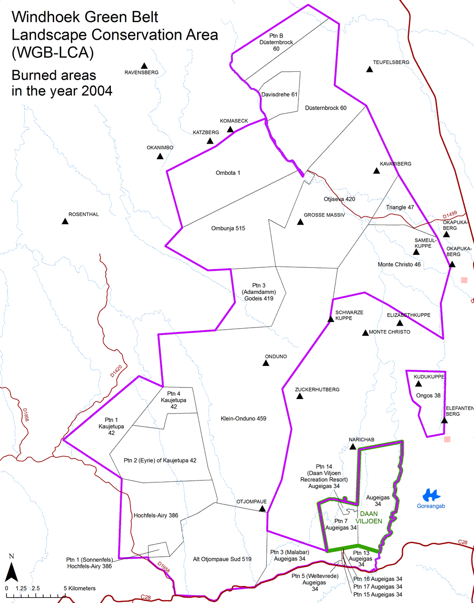
Burned areas 2004
map gif:
Navigation
Home
News
Tourism
Hiking
Gallery
Environment
Climate
Geology
Archaeology
Fauna
Flora
Conservation Areas
Socio-economics
Threats to the environment
Management
Our approach
Landscape members
Landscape development plan
Research
Rainfall monitoring
Interactive landscape maps
Landscape maps to download
The NAM-PLACE project
Literature
Contact us
Log in
Recent News
Public talk: Landscape conservation in the Namib
published
5 years 8 months
ago
Join the Standard Bank Khomas Hochland X-Trail run on the 5th of June
published
8 years 1 month
ago
Search
Search this site
Spread the word
2016 © Windhoek Green Belt Landscape
Back to Top
Website by
JARO Consultancy
Back to Top